


Environmental intelligence at street level
Real-time data from mobile sensor networks. Real measurements, not estimates.
The solution


The problem
Sparse static stations mean low-resolution maps and estimated data, not real measurements. Pollution stays invisible where it matters. No real street-level data.


Our approach
Sensors on fleet vehicles, 24/7 collection along real routes, processing in the cloud, delivery via APIs. The solution is one path: from the fleet to the cloud to you.
The Sparrow Nodes Fleet is that solution: fleet, cloud, you.

Nodes Fleet
Nodes on vehicles capture street-level data and send it to the cloud.

Sparrow Cloud
Processing, storage, and calibration in the cloud.

Data APIs
Validated data available via API for your apps and products.
Meet Sparrow Fleet
A network of vehicles fitted with Sparrow Nodes. They run normal routes while scanning streets and collecting high-resolution environmental data. Each vehicle is a mobile sensing unit for real-time, street-level coverage.


How it works
- 1Partner with fleet operators.
- 2Equip vehicles with Sparrow Nodes. Plug-and-play.
- 3Vehicles run normal routes. No change to operations.
- 4Data collected every few meters, uploaded in real time.
- 5Process and deliver via API.
Why fleet-based monitoring?
Full-city coverage
Coverage is what makes the data useful. Fleet vehicles cover entire cities daily, more streets scanned, more often, so your apps get street-level data where it matters.
High spatial resolution
Street-level data instead of a handful of fixed stations. Denser sampling means your maps, routing, and analytics reflect real conditions block by block. Better inputs for your models and user-facing features.
Scalable infrastructure
New city: partner with a fleet, install nodes, start scanning. No permits, grid planning, or large maintenance teams. Scale your data footprint with your business and bring street-level intelligence to new markets fast.
Cost efficient
Lower cost than building stationary sensor networks. Fleet-based collection spreads cost across existing operations. Premium environmental data at a fraction of traditional deployment cost.
Sparrow Node

What it does
The node is the core of our network. On the vehicle it captures environmental data along every route: air quality, road surface, noise. One device, many signals, continuously.
What it collects
Air: particulates, gases, climate. Road: surface quality and bumps. Noise: exposure and events. Plus GPS. Calibrated sensors, street-level resolution.
How easy it is
Plug-and-play. No structural change to the vehicle. Rugged, built for fleet use. Install and go.
What you get
Real measurements, not estimates. High resolution, frequent, mobile. Data ready for your maps, apps, and APIs.
Our hardware


-
Proprietary & Swiss-made
Full stack in-house. Designed, built, and produced in Switzerland. We control quality and evolution.
-
Lab-calibrated sensors
Sensors calibrated in-lab. Validated air, road, and noise data you can trust and build on.
-
Reliable & plug-and-play
Rugged for fleet use. No vehicle changes. Install and go; reliable in the field.
Data & APIs

Global Presence
Street-level environmental data collected by Sparrow nodes worldwide.
* Data current as of February 2026.
Coverage
Successful fleet deployments, pilot programs, and integrations in multiple countries.
- USA

- Switzerland

- Germany

- Belgium

- Hong Kong

- Azerbaijan

Sparrow CMS
Central Management System for the Sparrow sensor fleet: manage, monitor, and control devices in real time from one secure interface.


One place to oversee device performance, data flow, system health, and coverage across the fleet. Built for clarity and control.
For cities, enterprises, and data-driven teams, it turns environmental data into actionable intelligence. Visualization, data management, and APIs support operations, planning, and integration into smart city and product workflows.
About us

Sparrow Analytics is a Swiss-based startup, dedicated to exploring new opportunities and executing complex technology projects. Our vision is to become a global platform for data collection, harvesting, and processing for populated environments.
Use Cases & Resources
Explore live use cases and Sparrow materials: dashboards, manuals, and specs.
-

Sparrow at Wiesbaden Health Risk Index
Street-level data for the Wiesbaden Health Risk Index 2025.
-
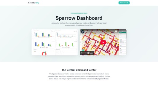
Sparrow Dashboard
Interactive dashboard for visualising and exploring Sparrow environmental data in real time.
-
Sparrow Product Manuals
Product manuals and documentation for Sparrow Node hardware and deployment.
-
Sparrow Product Specs
Technical specifications for Sparrow Node sensors, APIs and data outputs.
-
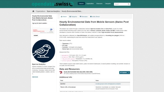
Swiss Post Open Data (Hourly)
Hourly GeoJSON from Swiss Post fleet sensors on opendata.swiss.
Our Values
-
Innovation
Better tech for accurate street-level data.
-
Integrity
Transparent data and methods. No black boxes.
-
Sustainability
Data that supports cleaner air and healthier cities.
Partners and clients

Esri

Swiss Post

UN Environment Programme

Federal Institute of Metrology METAS

University of Surrey

The Hong Kong Polytechnic University

Swiss Federal Institute of Technology Lausanne

Canton of Geneva

International Telecommunication Union

City of Antwerp

City of Wiesbaden

Port of Antwerp Bruges

Citymesh

Lookmove

Popety.io
Contact
Ready to use street-level environmental data? Get in touch.